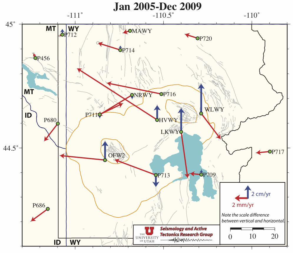
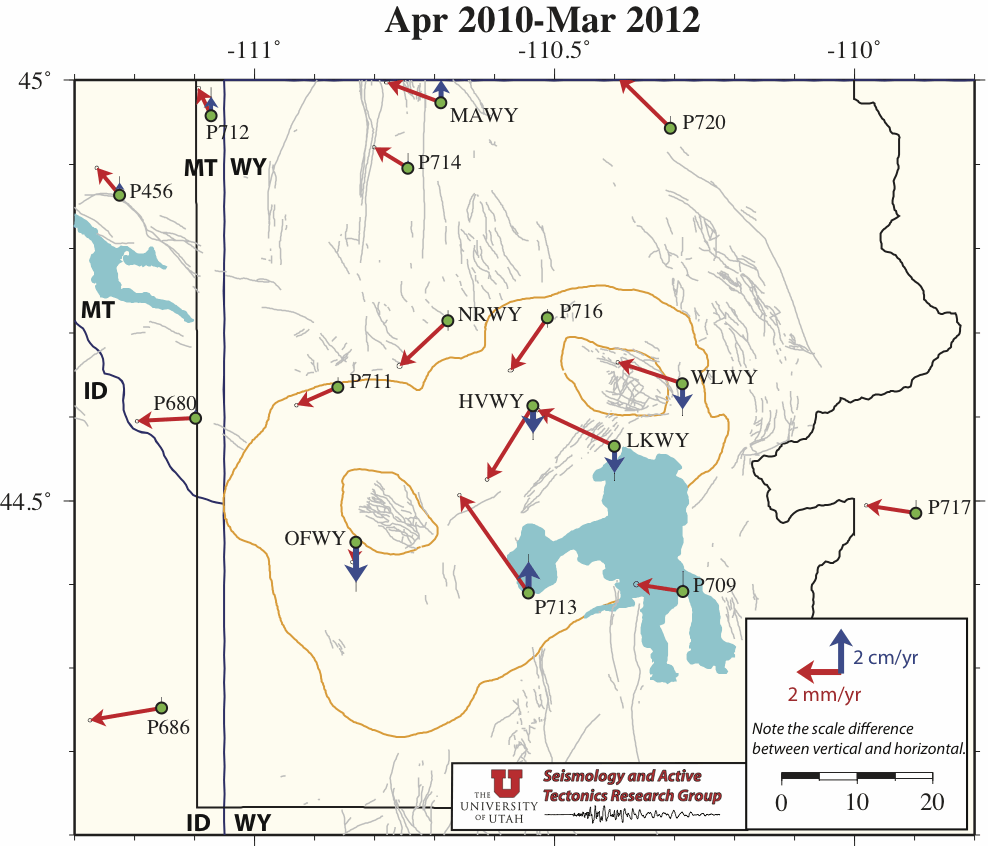
During mid 2011, you may notice an unusual reversal of ground motions from subsidence to uplift in the Yellowstone GPS data. We have noted the this may be a result of a seasonal, processing, or reference issue, nonetheless, we descibe it in the figures of our new page, "A Closer Look at 2011 Yellowstone Caldera Time Series and Velocities" (link below). The figures view the entire 2011 year time period including the time series of some key Yellowstone GPS stations and a comparison of Yellowstone's GPS derived ground motion velocieties between six month periods January through June and July through December of 2011.
http:\\www.uusatrg.utah.edu\caldvels_2011.html
Maps developed using Bernese GPS Software 5.0 and IGS refrence stations: ALBH, DRAO, GOLD, MD01, NLIB, PIE1, QUIN.
Go to Univerisity of Utah Seismology and Active Tectonics home page
Go to Univerisity of Utah Wasatch GPS network information page