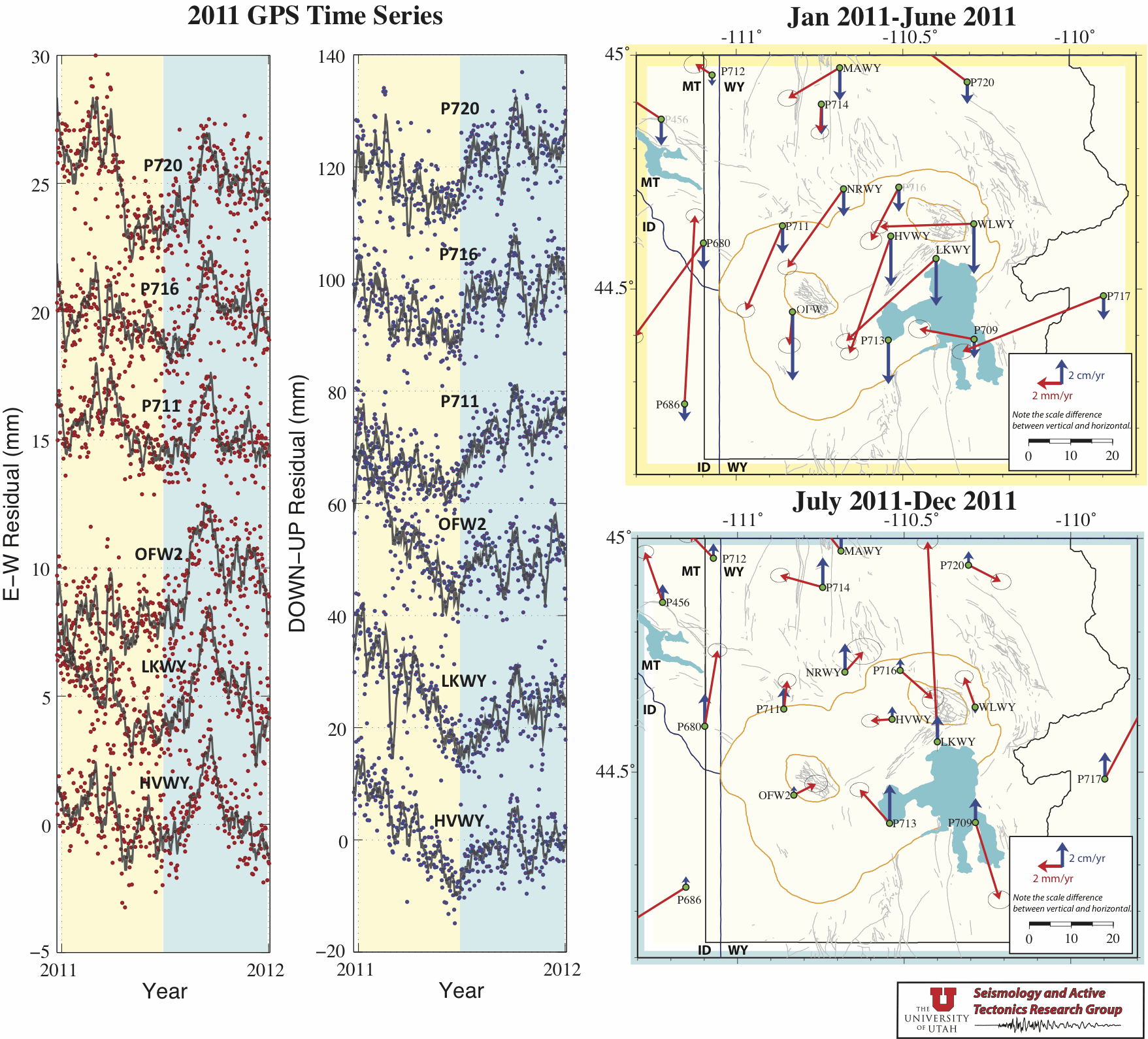
During mid year 2011, the Yellowstone GPS data began the reveal a transition from caldera subsidence to uplift in the GPS-derived ground motions. We note that this unusual reversal in ground motion may be the result of a seasonal, processing, or a reference frame issue, nonetheless, we describe it herein. The following plots are view of the entire 2011 year time period for key GPS stations in Yellowstone, with a comparison between the ground motion velocities derived from the GPS data of six month periods, January through June and July though December 2011. All data was derived from the Yellowstone GPS network and were processed using Bernese GPS Software 5.0 and IGS reference stations: ALBH, DRAO, GOLD, MD01, NLIB, PIE1, QUIN.
Go to Univerisity of Utah Seismology and Active Tectonics home page
Go to Univerisity of Utah Wasatch GPS network information page