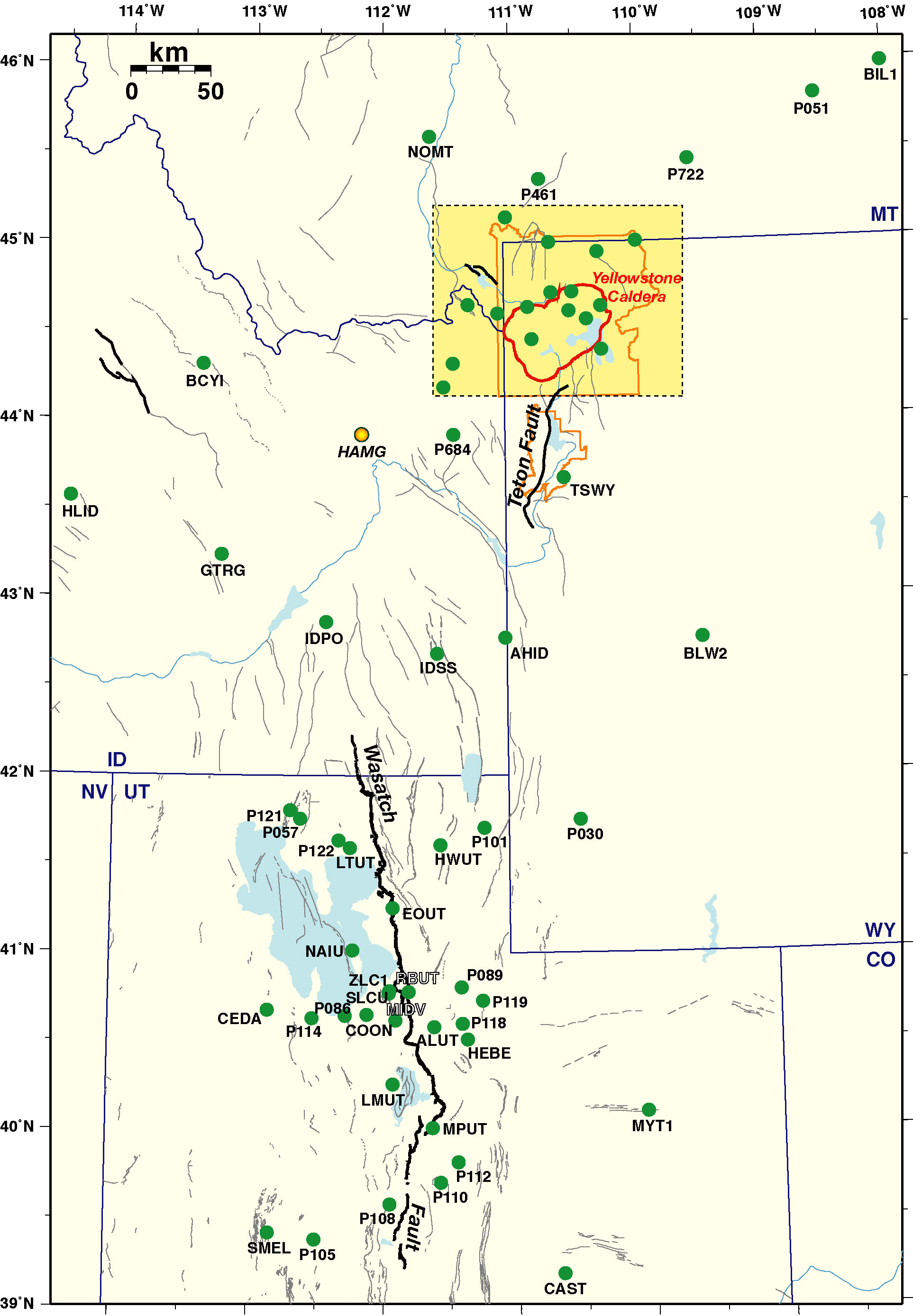
Continuous GPS Station Information
Yellowstone, Snake River Plain, and Wasatch Fault
(Click station name to view time series)
(Updated: Sep/2007)

  • We process the CGPS data, with IGS precise (final) orbit, using BPE (Bernese Processing Engine) . The daily solutions of station coordinates are constrained to seven remote NGS CORS sites (ALBH, DRAO, GOLD, MDO1, NLIB, PIE1, QUIN) in an ITRF2000 reference frame.
  • To get the time series (residual plot) of each site, we use the Helmert transformation to translate and rotate the coordinates of seven remote NGS CORS sites onto a stable North American reference frame.
  • Sites with * include time series from the MIT GPS Analysis Center of EarthScope PBO that processes GPS data (later than 2004) from the PBO network, Nucleus network, and selected other stations.

    Wasatch Front

    University of Utah

    EOUT* NAIU RBUT LMUT LTUT* MPUT* HWUT ALUT

    BARGEN

    HEBE* COON* CEDA* CAST* SMEL*

    CORS

    MYT1 ZLC1 MIDV SLCU IDPO IDSS

    PBO

    P057* P121* P122* P089* P105* P086* P119* P114* P030* P108* P110* P101* P112* P118*

    Yellowstone/Snake River Plain (YVO)

    Yellowstone Caldera

    LKWY* MAWY* OFW2* (OFWY) HVWY* WLWY* NRWY*

    Yellowstone Hotspot
    Teton Fault

    AHID* BIL1 BLW2* (BLWY) GTRG* HLID* NOMT* TSWY* BBID* HAMG (discontinued)

    CORS

    IDPO IDSS BCYI

    PBO

    P360* P680* P716* P720* P684* P709* P711* P721* P722* P460* P461* P051* P676*

    Go to Seismology and Active Tectonics home page
    Go to the permanent GPS horizontal ground motions page

    For questions regarding this page, contact Wu-Lung Chang: wchang@mines.utah.edu