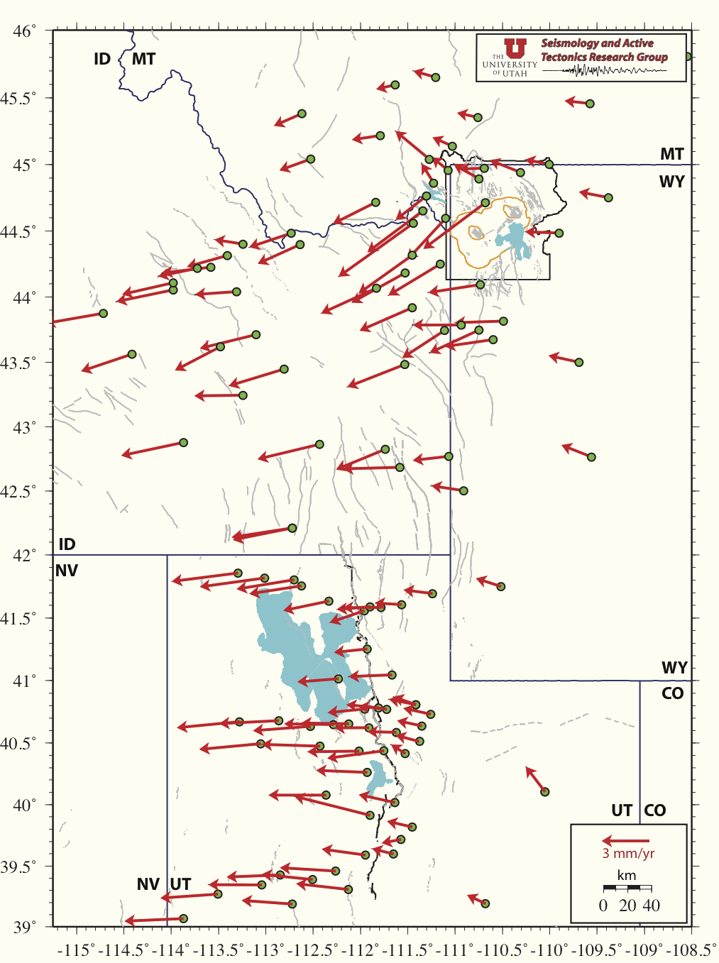
Apr 2005-Mar 2012 Yellowstone/Wasatch Front Combination GPS-Derived Velocity Map
Due to the obvious separation in distance, since the 1990's the Yellowstone and Wasatch Front GPS networks have been viewed as two individual networks. Over the past several years, the number of GPS stations in both Yellowstone and the Wasatch Front have been increasing in number and in overall area covered. As seen by the figure below, the two networks are beginning the merge into one, much larger nework. This new addition to our web page shows experimental velocity field results of the combination of the Yellowstone and Wasatch Front GPS networks.
Velocities w/ stations labeled
Maps developed using Bernese GPS Software 5.0 and IGS refrence stations: ALBH, AMC2, DRAO, DUBO, FLIN, GOLD, MD01, NLIB, PIE1, QUIN.
Go to Univerisity of Utah Seismology and Active Tectonics home page
Go to Univerisity of Utah Wasatch GPS network information page
Go to Univerisity of Yellowstone-Snake River Plane GPS network information page